Milepost 80 (30 miles north of river (Rio Grande River), the land changes from mainly farm and crop land to ranch land, much of it untouched in years. However in the midst of the ranch land along the way, I saw miles of sunflowers in the fields.

Milepost 118 (68 miles north of river) we go through an immigration and security checkpoint. There is a checkpoint at the river, but then we have another one. From the Valley to this point, many illegal immigrants get stranded and lost in the thick ranch brushland of this part of the state. The county where this checkpoint is located have founds hundreds of dead bodies in their ranch land.

Milepost 213 (168 miles north of river) I crossed the Nueces River, which was the original boundary between Mexico and the Texas territory. This river runs quite close to San Antonio where the battle of the Alamo took place. I always wondered why the Mexicans went so far north to do battle.
Just north of this river, we really start to use the impact the natural gas and drilling has on this part of Texas. This refinery has been here since before we moved. Now with the discovery of the Eagle Ford shale, there is boom of growth in the towns in the area.

The Eagle Ford Shale gas formation was discovered in 2008 and is unlike many other shale formations because it has both oil and natural gas resources. Located in Southwest Texas, the Eagle Ford Shale is estimated to have 20.81 trillion cubic feet of natural gas and 3.351 billion barrels of oil. The formation ranges in depth from 5,700 to 10,200 feet and covers over 3,000 square miles.
Supporting Texas Communities

Milepost 225 I bought my first bag of Twizzlers....my travel food of choice!
Milepost 265 Drove through the small (but growing due to all the drilling in area) city of Pleasanton. It bills itself as "the birthplace of the cowboys." I wondered about that until I looked it up Wikipedia (see below)
The roots of the cattle kingdom can be traced to Atascosa County in the 1860s, which calls itself "the birthplace of the cowboys."
Milepost 265 - 270 Monsoon rains of which I have not seen the likes of in years! Could not find a place to pull over as the ditches were flooded and finally found a country road that went down hill so that I could pull off the road. After about 15 minutes of waiting and calling my hubby and asking, "Are they forecasting another Noah's flood for south of San Antonio?"
It did let up some so that I could get back on Hwy 281. I was coming up to an intersection and most vehicles had there emergency flashers going. I could see a car in the right lane and it didn't seem to be moving. Quickly I changed lanes to the left and parked my car in an intersection. This photo was taken after several Good Samaritans stopped to help this lady.

Milepost 300 -- Wow! I could not have planned that any better.... it's in downtown San Antonio.

Texans sure like their state flag! I think you will see more Texas state flags on display than the USA flag. Guess that's why it should not seem abnormal that only a few years ago, our governor was talking secession.
One of the most famous attractions in San Antonio is the RiverWalk. It's a canal that flows through part of the town (one story below street level) and has tons of shops and restaurants.

Here's a view from street level.

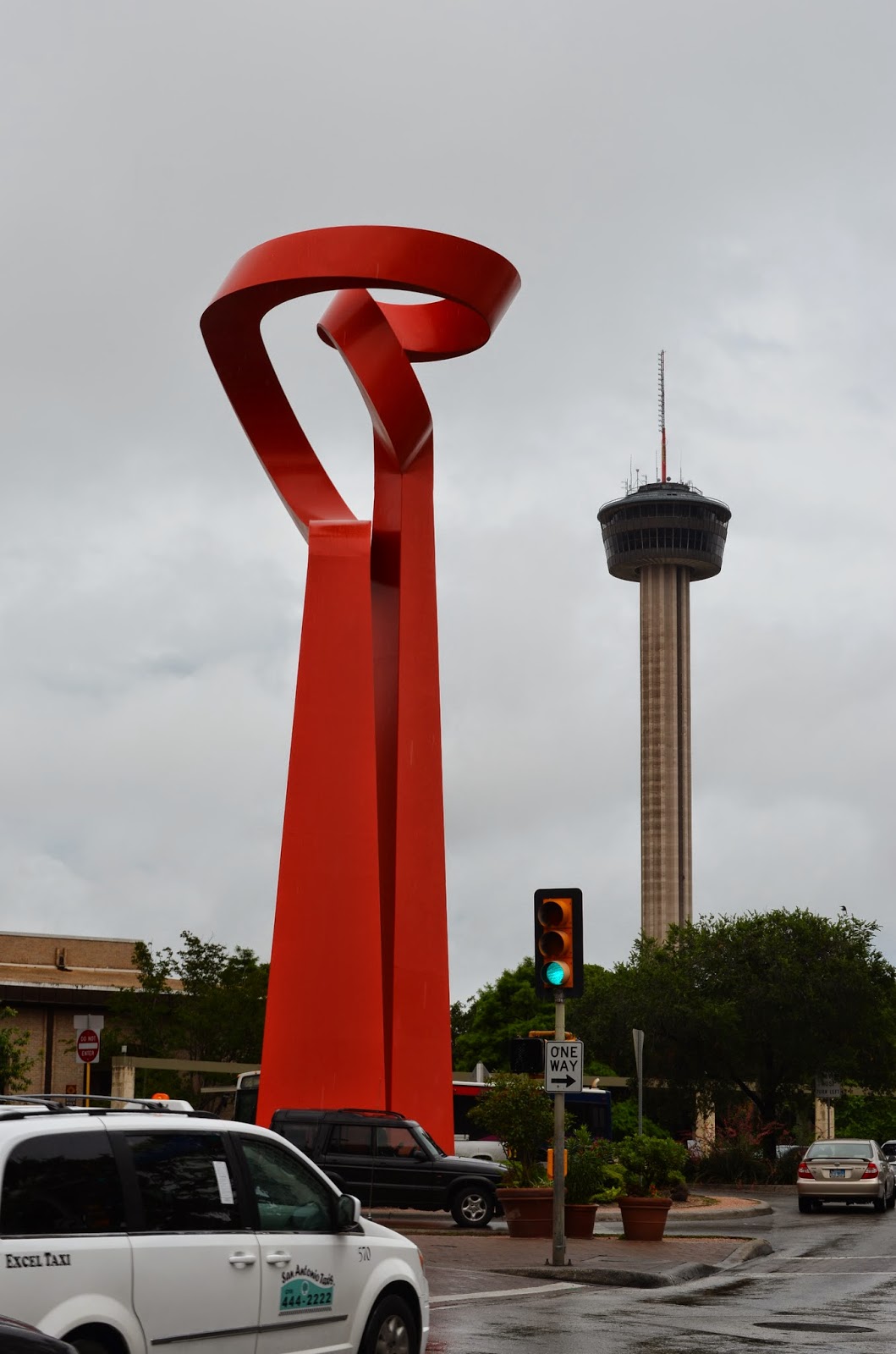
On a nearby street corner you can see a sculpture and the Hemisphere Tower that was built for the 1968 World's Fair.
There is a historic area call La Villita that is just above the RiverWalk. The old homes and shops are still being used for selling and displaying art and crafts. Very quaint walking area.

Sometimes the opposite of quaint is unique or bizarre. So it is, that another famous site (since 1881) in San Antonio is the Buckhorn Saloon.

It is truly an interesting museum, full of every kind of stuffed....fur, fin, and feather!
Many people that visit San Antonio only go to the RiverWalk and a few streets beyond that. However, San Antonio's early settlers were Indians, Mexicans and missionaries. There are a string of missions along the river and most are original. These missions were basically forts and the people lived within the walls (most 2-3 feet thick). This protected them from invaders and provided a community to all. These missions are about 3-5 miles apart. The most famous mission and the furthest north mission is the Alamo. This is where the Battle of the Alamo took place in 1836.

The next mission south is Concepcion, which has been serving, and continues to serve Mass since 1731 and is in the best shape of the missions.

The bells in the tower of the Mission Espada have made it famous with photographers.

The other two missions of the five are San Jose and San Juan. Here is photo of an old door at San Juan. I love OLD doors and window and buildings and roads.... I guess I love OLD!

San Antonio is the by far the largest community that Highway 281 goes through. It is the fourth largest city in Texas and 25th largest city in the USA. Lots to see, lots to do! Until tomorrow...adios!
No comments:
Post a Comment